Forestry

Credent is one of the early movers promoting the use of LiDAR in equatorial forests such as Borneo and has produced pleasing results for various forest conservation and research groups. LiDAR immediately illustrates and quantifies slope / aspect, watershed, biomass, tree heights and density, and assists in harvest and timber extraction planning. Colour and NIR imagery are useful for visual identification and interpretation of species and forest health.
Mining
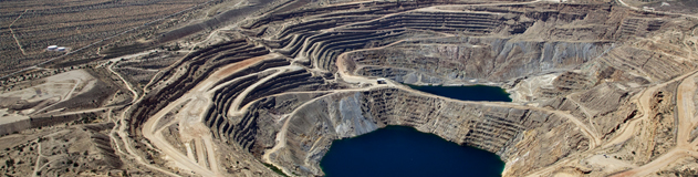
We have a wealth of experience collecting aerial imagery and LiDAR for miners. These collections are often used to determine biomass as well as providing accurate terrain models and identifying orthomorphic structure supporting exploration and initial earth works. Subsequently aerial mapping is useful for monitoring open cast mine development and environmental concerns, such as tailings.
Plantation Agriculture
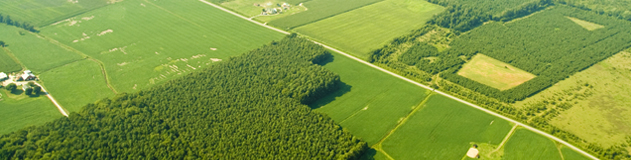
We have experienced that LiDAR and multi-spectral orthophotos are becoming widely adopted in plantation management to illustrate slope / aspect, define water drainage patterns and assist in irrigation planning; and development of new plantations. Using high density collections, LiDAR clearly identifies individual trees and provides tree heights, crown size; and an indication of health at various stages of the production cycle using NIR imagery.
Flood Mapping & City Modeling
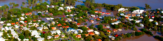
A common issue for low lying coastal cities in south-east Asia, often historically situated around and along silted rivers. LiDAR is an efficient an unobtrusive method for quickly collecting highly accurate height information used for flood modeling. The 3-D information includes the surface model of the city, and the accompanying intensity image and photography identifies surface materials used by hydrologists to determine absorption coefficient and run-off.
Transportation & Infrastructure
LiDAR combined with imagery has an obvious advantage in route planning for new road, rail, pipe and transmission line infrastructure; however it has also proven useful in the maintenance and monitoring of existing assets and infrastructure, for example, to assess the urgency for maintenance; investigate pavement damage on roads, thermal leaks in conductors in transmission lines and gas leaks in pipelines; and encroachments under high-tension power lines.